Google Maps, Optimizing Map Labels for Shallow Zoom Levels.
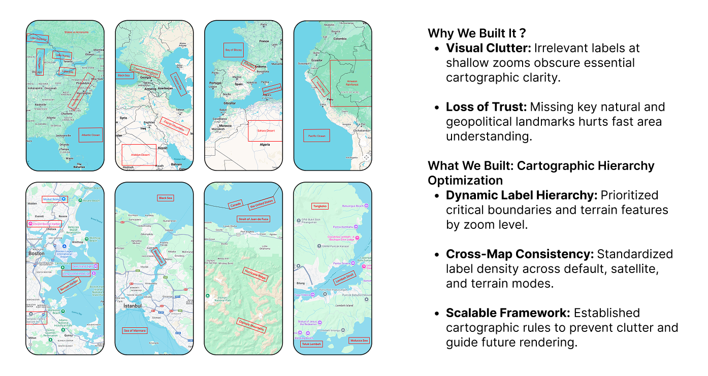
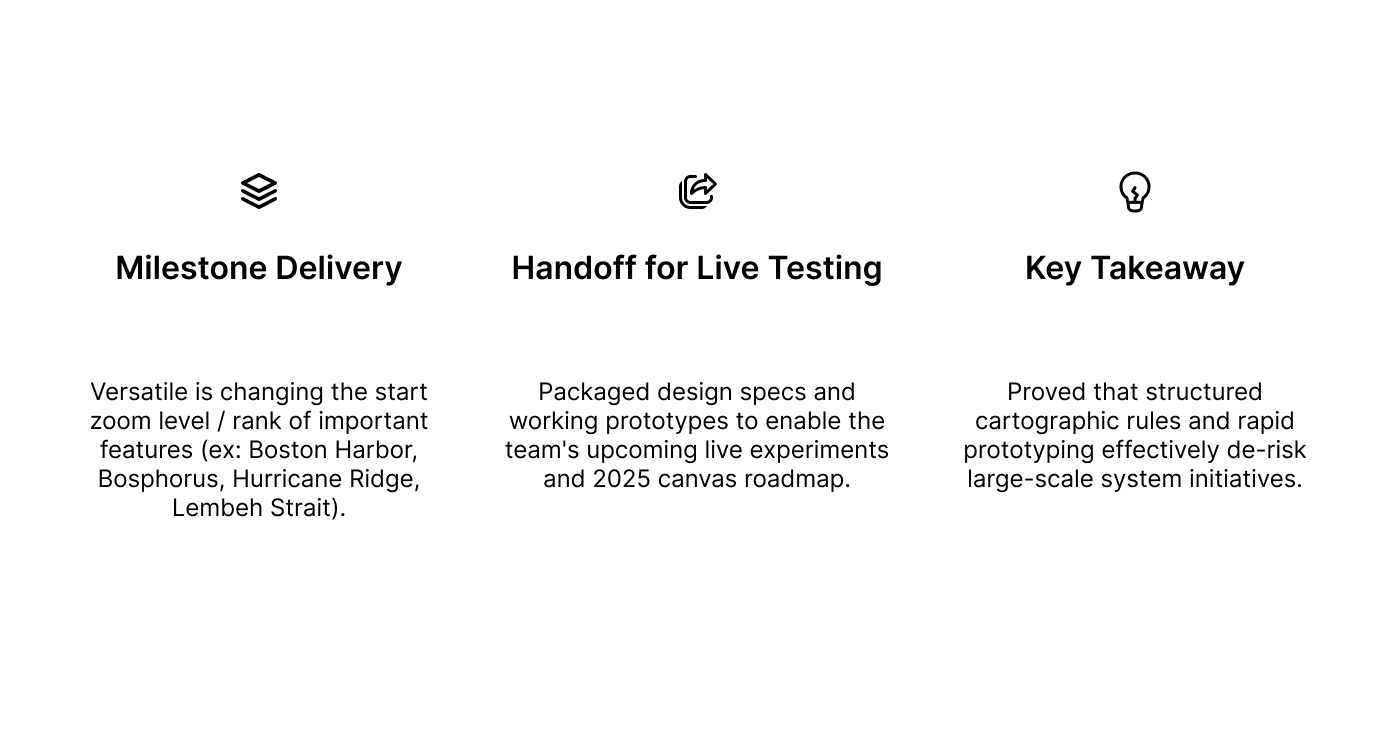
Google Maps suffered from visual clutter at shallow zooms, where low-priority labels obscured critical natural and geopolitical features. I led the strategy and prototyping phases to re-architect the basemap's label hierarchy, building working Legend prototypes and delivering a scalable cartographic framework that de-risked the multi-year canvas roadmap for live experimentation.
Section columns
Highlights 🤩
Why and What?
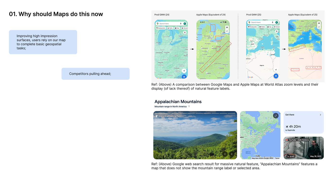
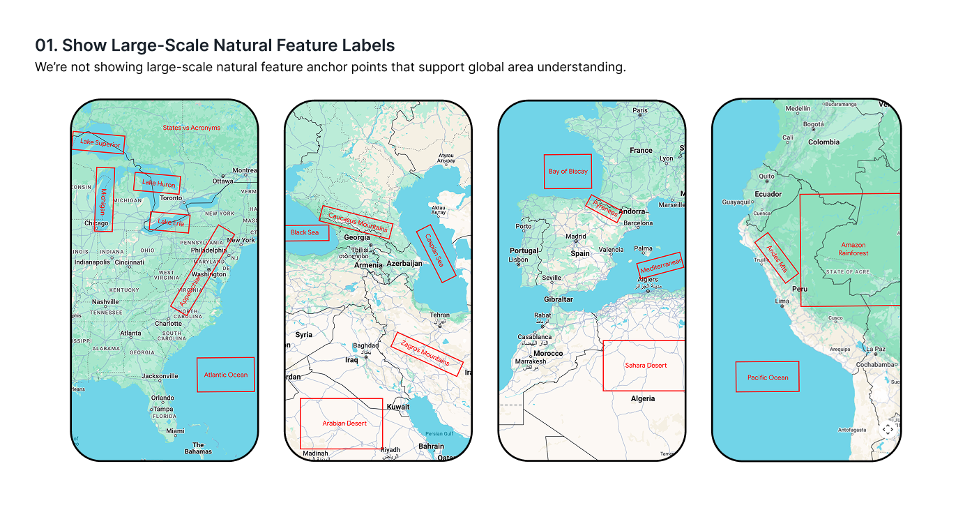
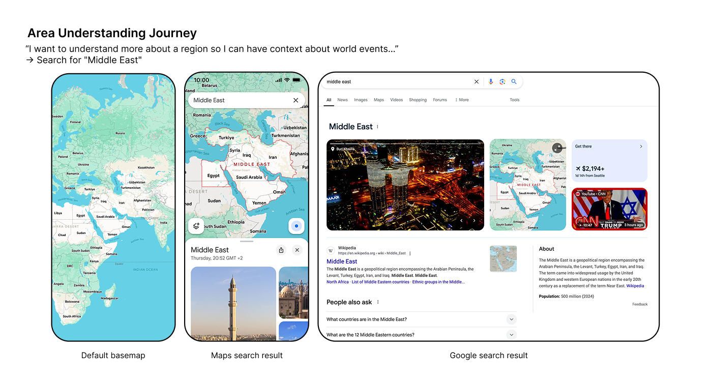
Currently, Google Maps often fails to display critical labels, such as natural features and area names, making it harder for users to understand their surroundings and grasp spatial relationships. As a result, users are forced to turn to alternatives (like Google Search, TikTok, Instagram, static Google Images, or social media videos) or abandon their search altogether.
Design process
The project spanned four phases: Forage (prioritize zoom labels), Demos (build interactive Legend prototypes), Alignment (secure leadership sign-off), and Launch (run live experiments to evaluate GMM impact and deliver CMR recommendations).
Phase 1: Forage
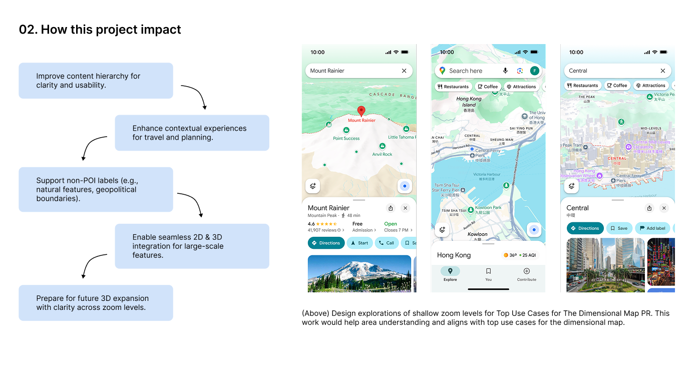
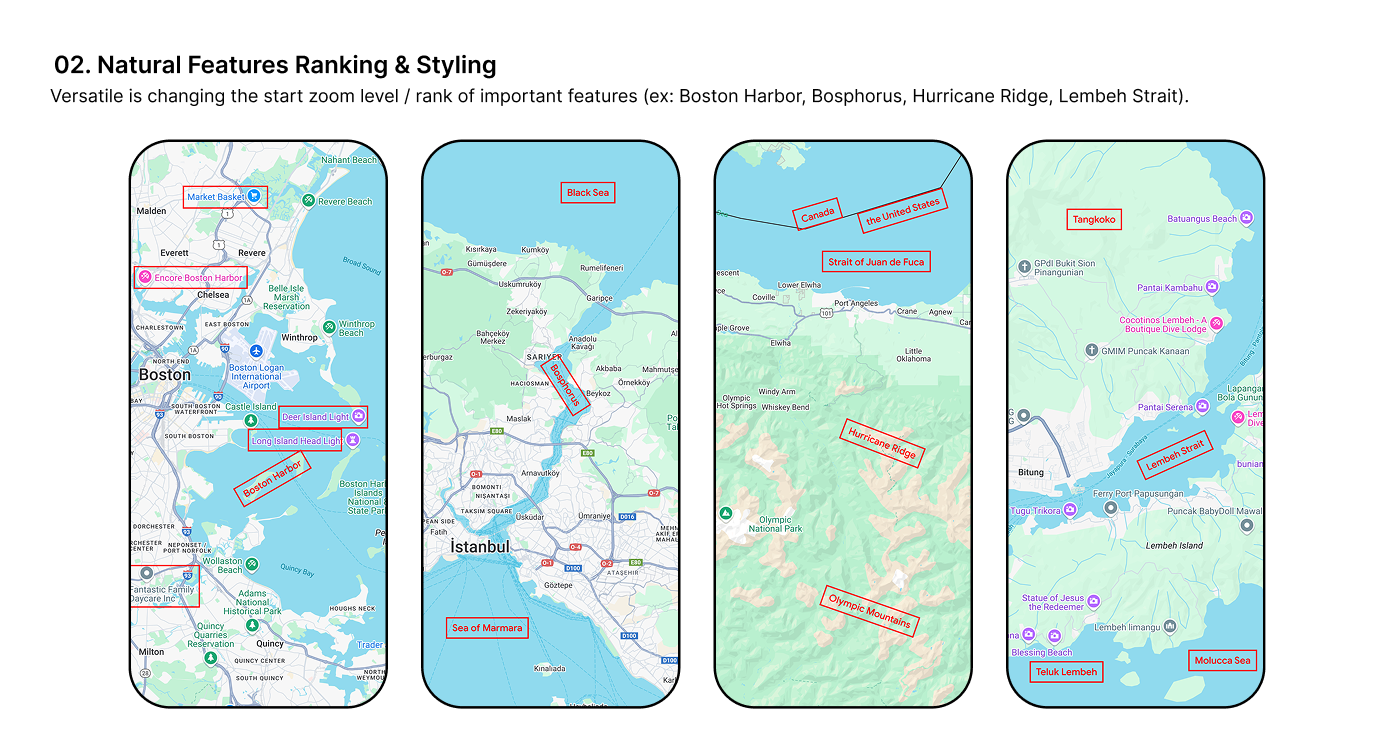
Conducted a deep-dive exploration with visual design to audit user value and prioritize which natural features and geopolitical labels should appear at shallow zoom levels. Defined visual styling updates, established core success metrics,
Phase 2: Demos
Formulated attribute-level hypotheses and collaborated with engineering and design to build interactive prototypes using the Legend engine. Ran rigorous internal reviews across the cross-functional pod to evaluate label hierarchy, density rules, and legibility in real-time map environments.
Impact & Strategic Handoff
environments.
More UX/UI Projects